106 #datahackdays #bern
This has been a hackathon year once again, I was fully involved in supporting the official cantonal hackdays of Bern and Uri, bringing together the City and Canton, the public and the private, giving more people the opportunity to get interested in IT for public services - as a learning experience, for critically needed scrutiny, for job opportunities and more.
As a summer heatwave ramps up across Europe, I find myself in the middle of preparations for a dozen hackathons in the months ahead, particularly looking forward to writing more about in this blog about the seven hackathons of the Swiss {ai} Weeks.
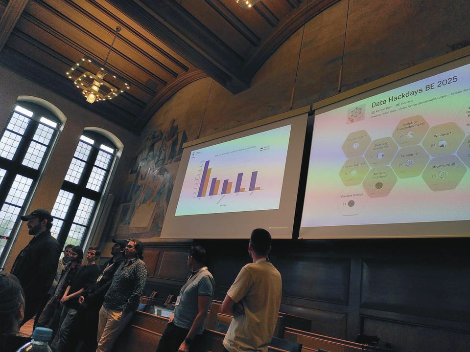
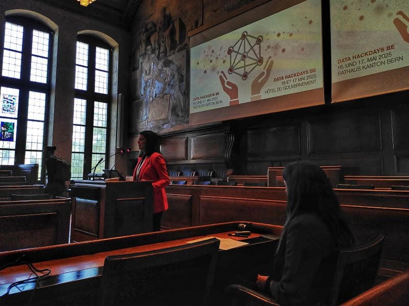
But first, I would like to take a look back at the Data Hackdays BE, the hackathon that a broadly anchored committee organized last May together with the Universities, Parliamentary services, IT and other departments of the Canton. There are already some excellent reports about the event, including official, social and media coverage:


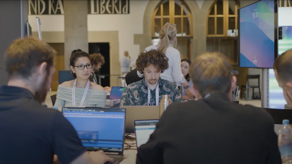
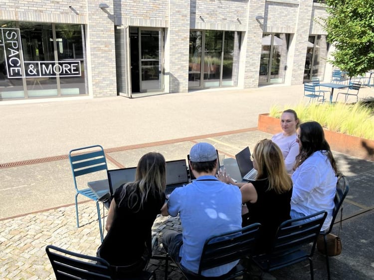
Together with the other fellow facilitators and coaches, I ran around helping all the teams, keeping an eye on logistics, answering tech questions, and operating the hack.data-hackdays-be.ch (Dribdat) online platform.
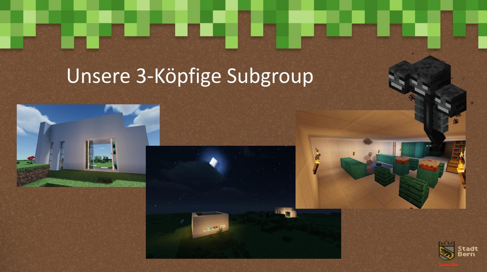
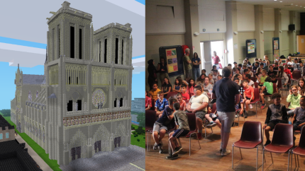
One group in particular did a great job of documenting the play-by-play experience, Bern in Minecraft: one of several projects proposed for continuation at the {ai} Hackathon in September.
I strongly doubt that you have never heard of the sandbox game and cultural phenomenon that is Minecraft, but if you have not tried it, there is no excuse: just take 5 minutes to visit a Web version of the original game on your laptop: https://classic.minecraft.net/

Some things are better experienced live. Nevertheless, here is my translation of the documentation of the Bern in Minecraft project, from the original notes in German:
Bern in Minecraft
Our goal: create a map of Bern for Minecraft in Java Edition. This map should be generated based on geodata of the city of Bern and thus become a digital twin.
Challenge Presentation (PDF)
The challenge participants have been working with the information and by noon have decided their strategy and sketched-out a process. Despite being quite a large team, they have decided to continue working as a large group until further notice. So far, promising approaches have been found, especially with WorldPainter and QGIS.
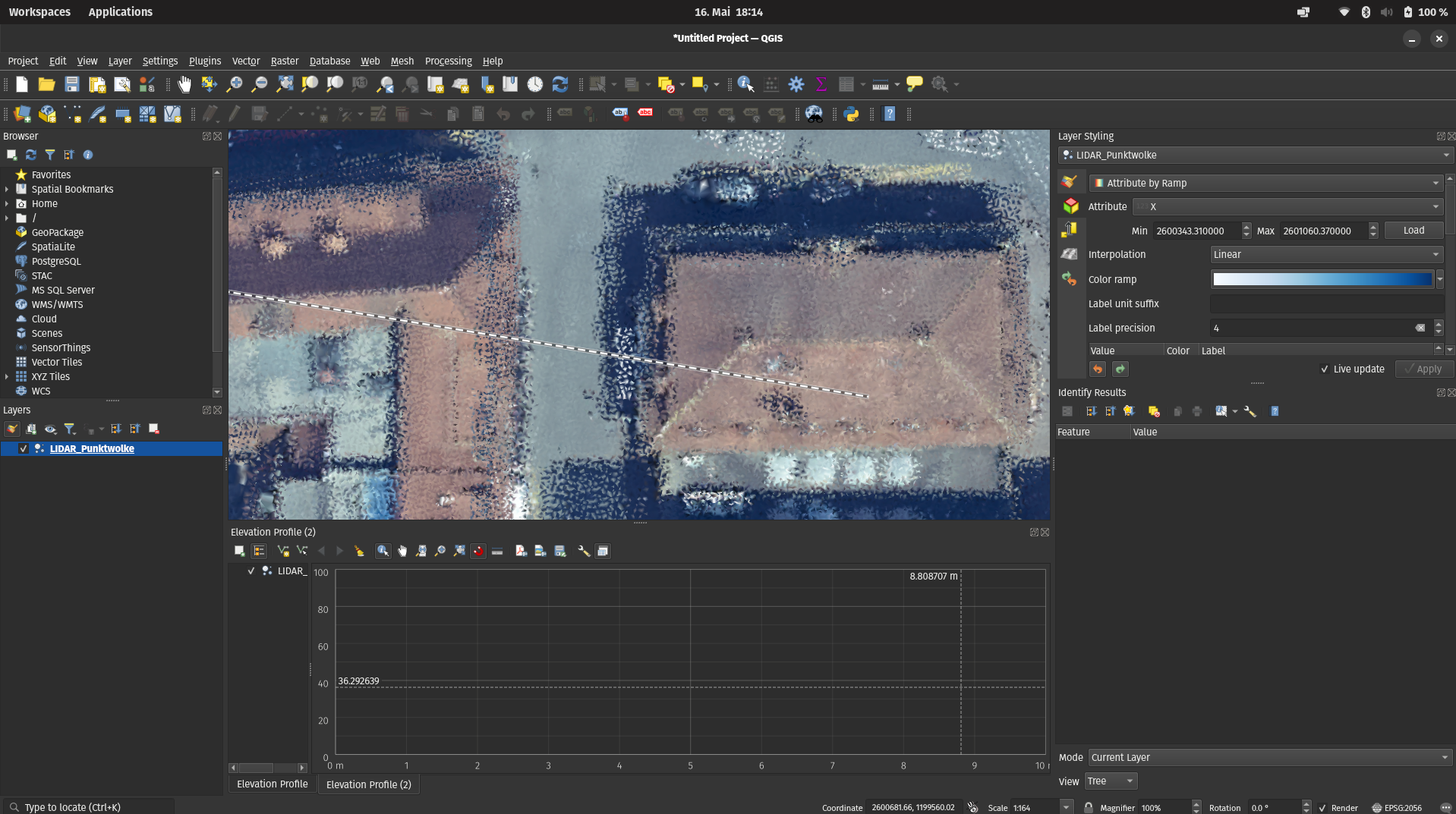
A challenge participant presents the current status of the results. Currently, the team is facing the challenge that after initial successes with WorldPainter and QGIS, the elevation model is not really being represented and only a flat world with few details is being generated.
The question arises whether the missing information should be added manually, or whether further research should be conducted to find a solution that can provide all the necessary information for automated creation.
The first tentative hopes are being placed in Blender and programming with Python, which is why further research is being conducted. At the next break, the team will decide which path to pursue.
During the break, it was decided that various approaches would continue to be pursued. There are still promising hopes of using Blender to obtain the necessary automation processes, including the information that has been missing so far. In addition, the Python plugin in the Minecraft editor Amulet was further developed. The LIDAR point cloud was used as the data basis for this.
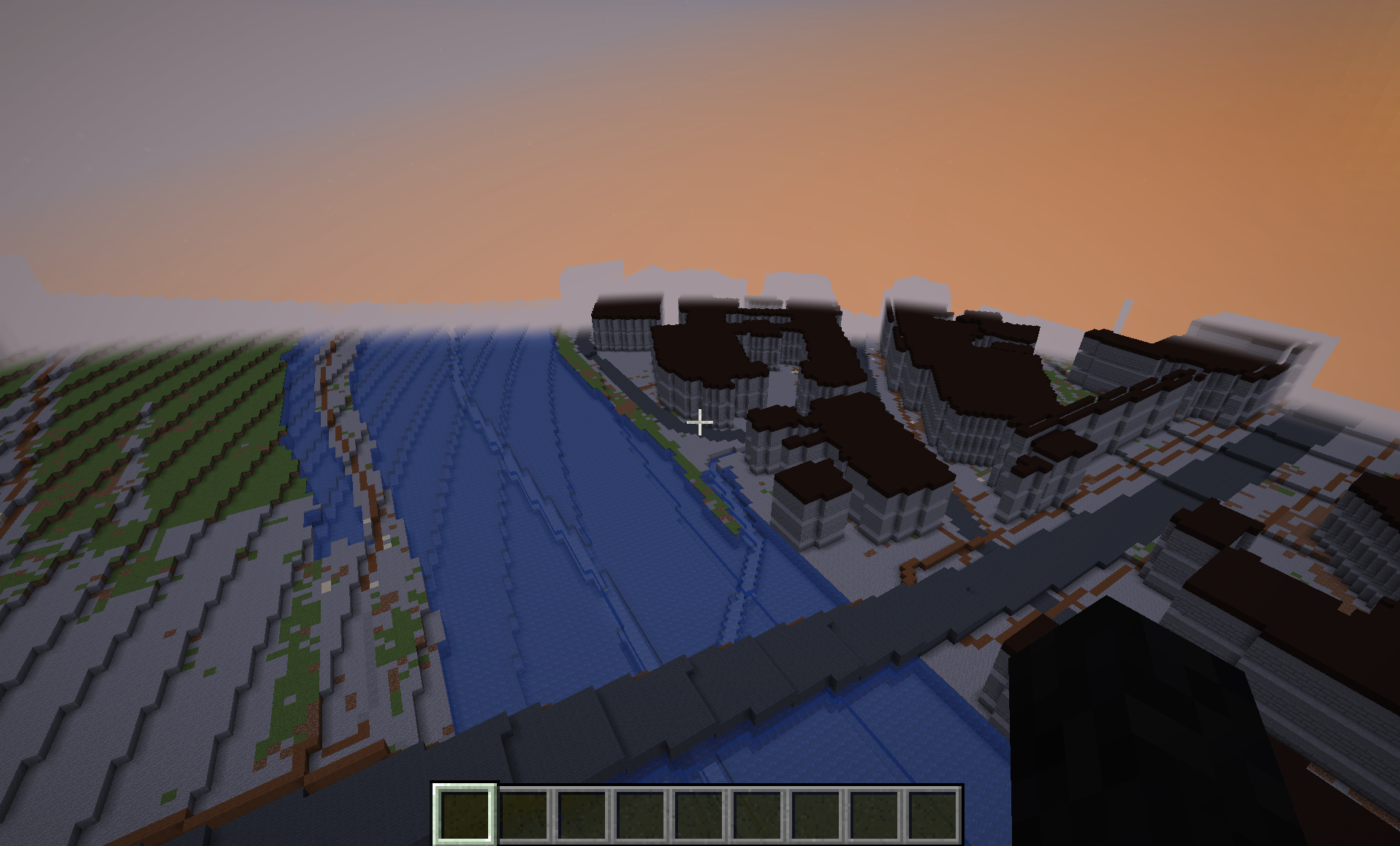
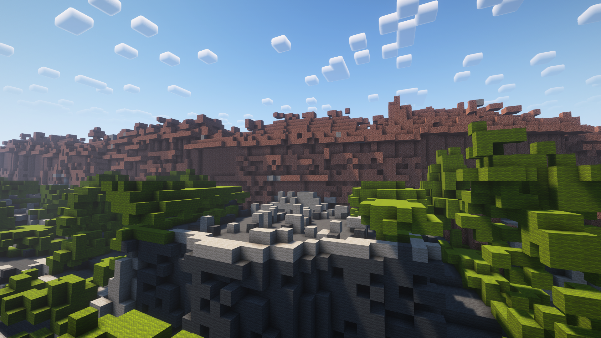
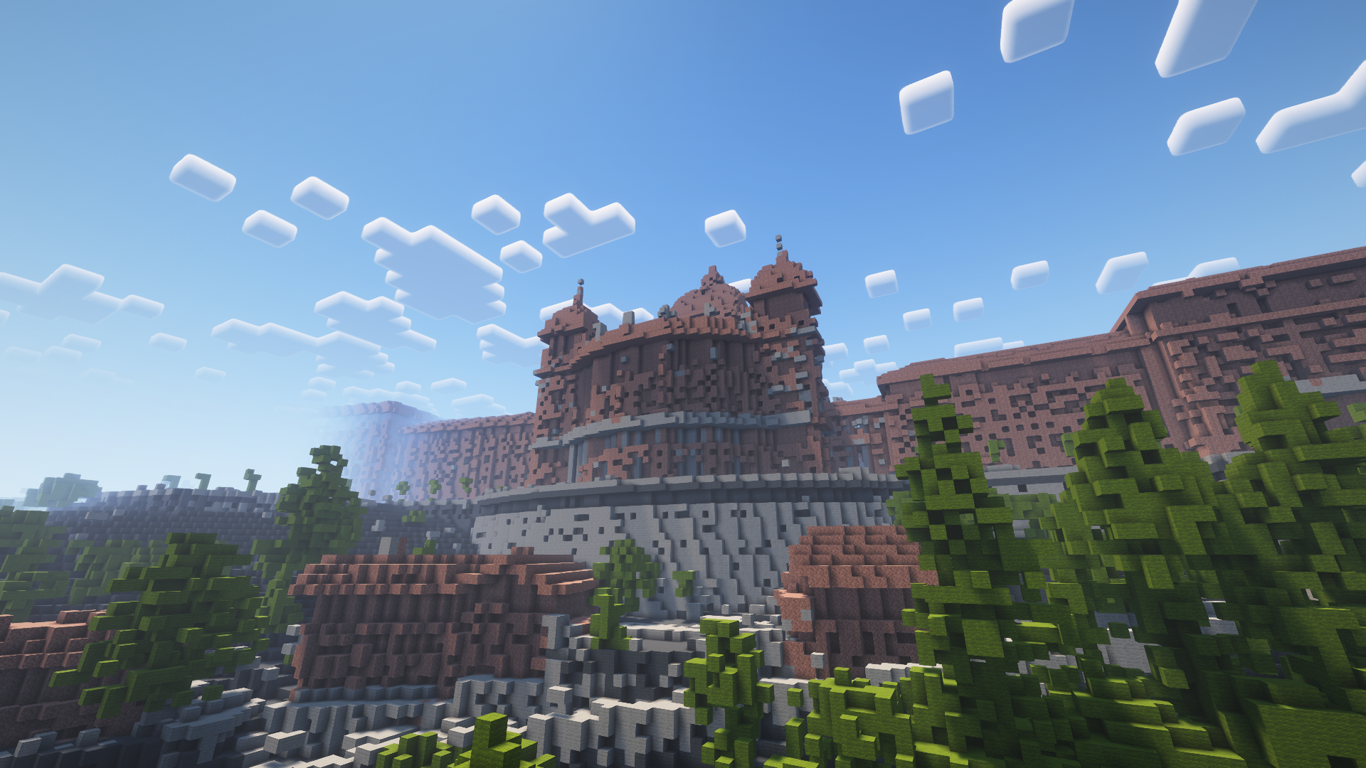
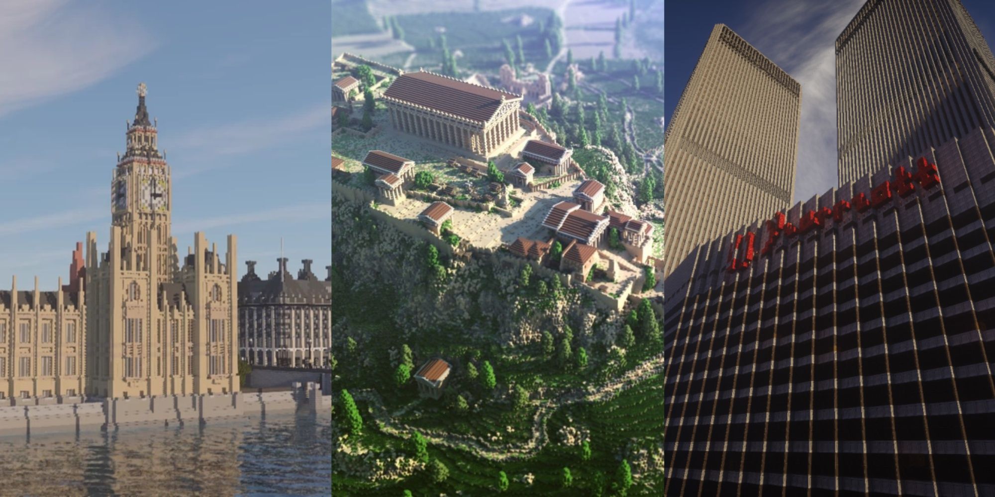
The example of the Federal Palace of Switzerland could show how well the chosen approach works. Only the colour information could not be included so far. However, work is being done on this. The majority of the team is still working on the WorldPainter and QGIS version. The goal is currently to merge the work at the end and in particular to generate the more demanding aspects such as the prominent buildings separately beforehand.
The team has decided to set up a server for the joint development of the map of Bern in Minecraft. A corresponding builder tool (plugin) should allow for the faster creation of blocks. Meanwhile, the colour information could also be passed on in the Minecraft editor Amulet using a Python plugin. The Federal Palace of Switzerland already looks very magnificent.
The team is thinking about how to put the work together. This will certainly be a big task for the second day of the Data Hackdays. In the meantime, a solution has been found for providing a server for the joint further development of the map for Minecraft in Bern. The entire team is full of confidence.
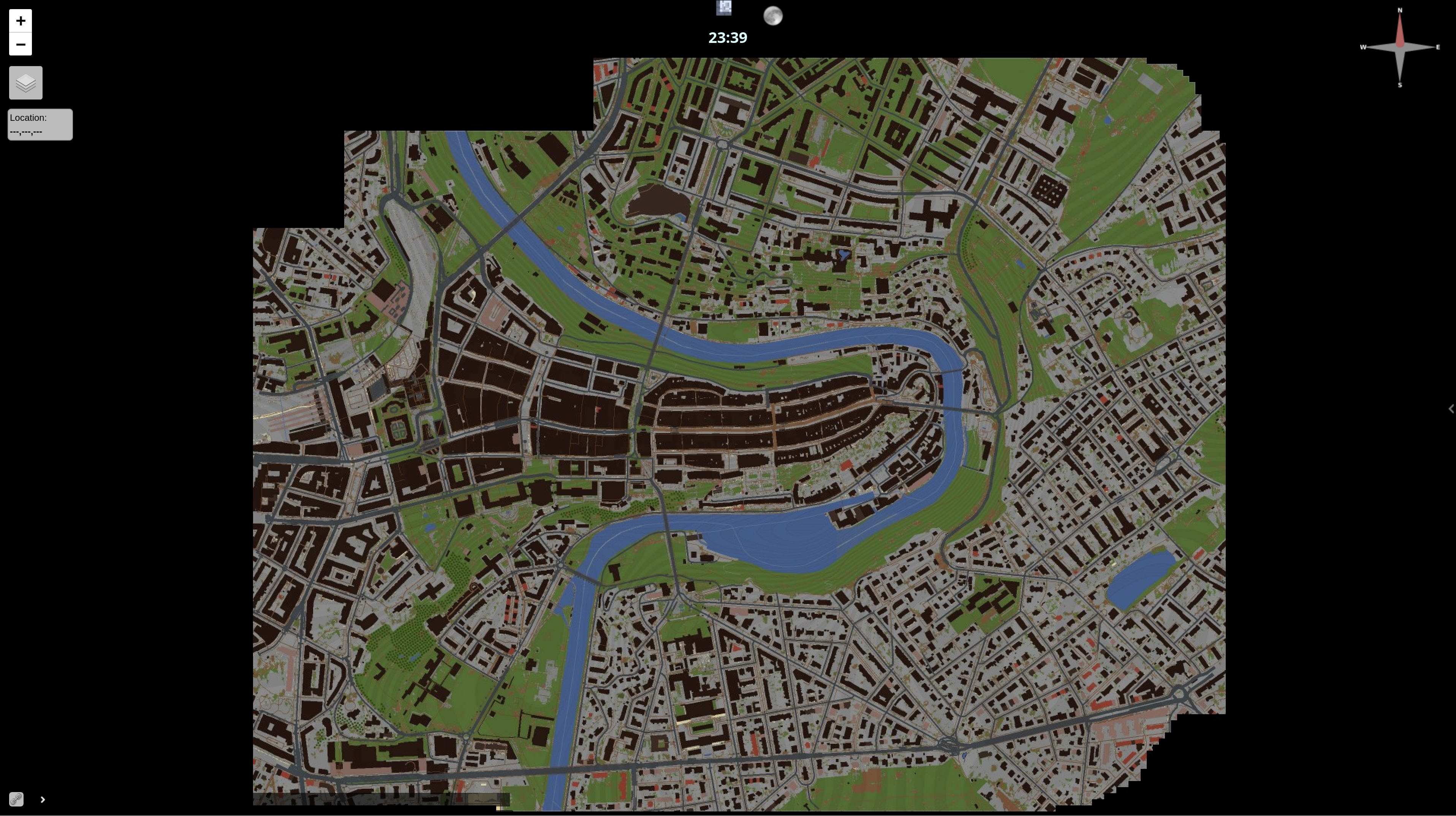
The second Data Hackday begins and the server is set up and ready for the Minecraft map.
The map is now running on the server. The whole team is enjoying the beautiful result!
We recorded a couple of fly-throughs over the old town, one of which you can see here:
The work could be finished on time, and a first MVP made available. The following presentation shows the approach as well as the results of the group. You can also download the source files from the second link.
- Final presentation (PDF)
- Hackdays project (Dribdat)
- Server configuration (GitHub)
- Amulet Editor importer (GitHub)
Side-project with Kids
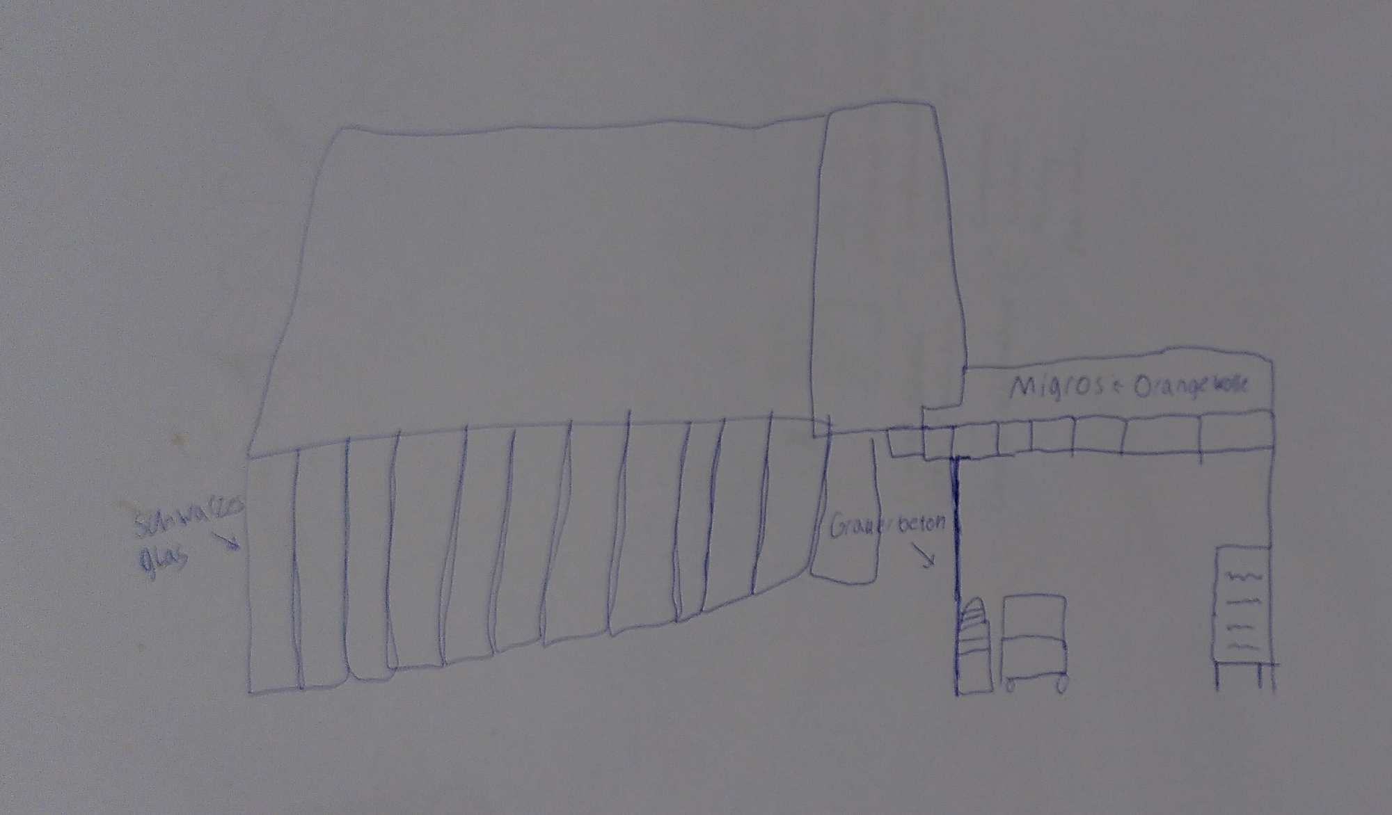
As noted in the presentation above, a small subgroup of 4 youngsters, children of hackathon attendees, did a parallel project with its own interesting story. They started by sketching small maps of familiar places in Bern. For instance, this sketch shows the layout of a local grocery shop:
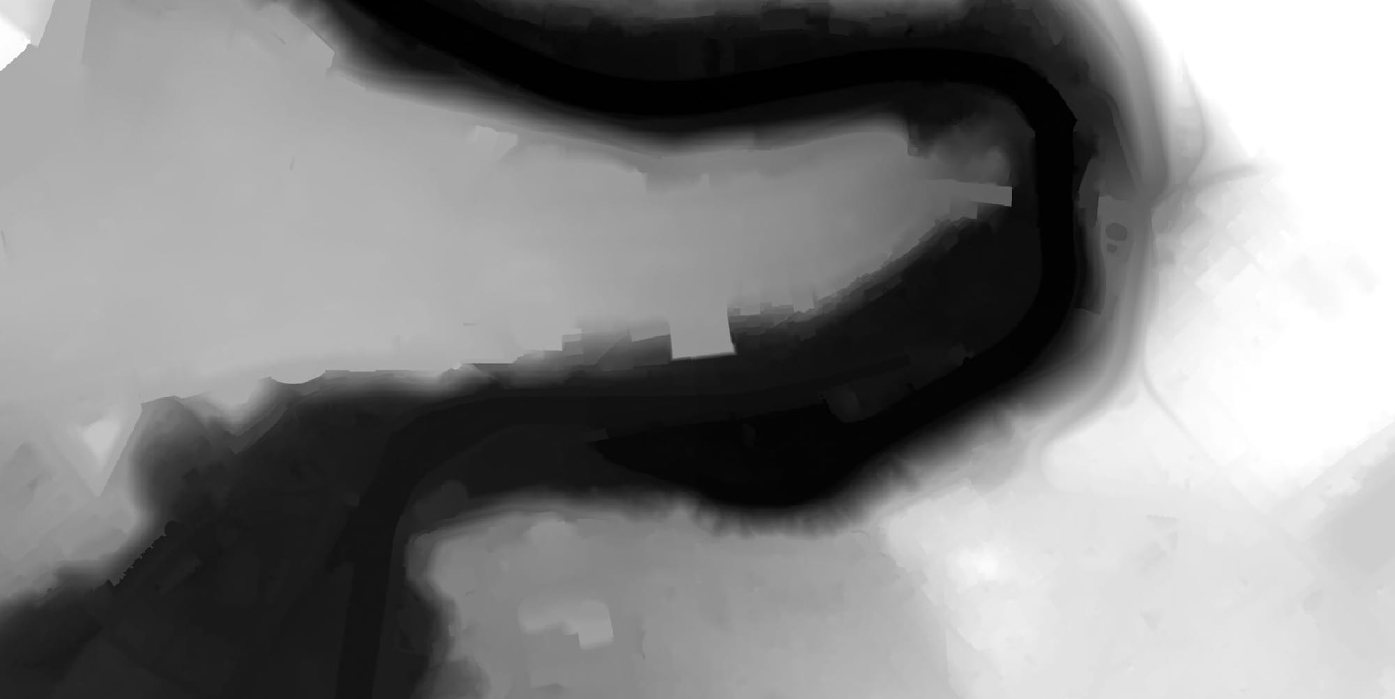
Then a small private Minecraft server was set up, on which they started building up their ideas. The server's map was an accurate topography of the old town of Bern that we already prepared using this Swisstopo ALTI3D data before the hackathon:
One or two already had experience with the tools, others quickly picked up from the others. After a two hours - while the adult team was still planning and only beginning to import data, they already had some initial results to show. The parents of course made sure to limit screentime, the kids went for a lunch outing and tumble in the park, which added an additional constraint to this group's work.
It was in the mid-afternoon that disaster struck. The kids came back to a server that was completely ruined, destroyed by griefers who not just wrecked their work. Some gory screenshots are in the team's presentation, but I don't want to promote this outrage here. How could this happen on a private server with a non-standard port address? My first guess is that one of the kids laptops was being keylogged or screenjacked and the connection details got leaked. Someone may have even dropped the link into a group chat.
In fact in a way this was an excellent educational experience, teaching the group the value of backups and passwords. It was a way of acknowledging a widespread spam/hacking problem online, understanding preventative measures, and comparing the cost and effort of running a private server to the Mojang/Microsoft-backed Realms cloud service. If you'd like to dig into this a bit more, here are some starting points: KittyScan, AuthMeReloaded, SneakyServer, Hacking Allowed.
The good news is that after installing some of these tools on the final (adult and kid teams) instances, we ran two hacker-free public servers for the following 3+ months, and active system maintenance and rights management is something that any further officially supported services will need to account for.
Discussion
During the challenge, many ideas were generated on how the experiences made and the enjoyment of the game and the shared experience can also be shared with the population. The suggestion was made to make the Bern 3D world available on the server of a Bern-based association at first. This should create experience and not least also trust, so that synergies between the population and the City of Bern administration can be created in a possible next step.
By creating innovative immersive encounter and experience worlds, the team felt that the City can increase the participation of people in different life situations, democracy and thus the quality of life of its population. This will create the conditions favoring sustainability. The Bern Minecraft Map arouses the interest of people young and old in models of urban architecture, which are topics bordering on spatial planning and geomatics. In addition, the use of 3D immersive games promotes spatial awareness in the real life.
The following are examples of possible applications:
- Simulations and serious games
- Role-playing games on relationships, e.g. in politics or business
- Construction events, architecture walks
- Playful and inclusive learning environment
- Meeting point, event calendar
To make such and similar applications possible, it would make sense to start with a pilot project. A suitable organisation can be supported by suitable partners for hosting, applications, moderation and publicity. We mocked up a simple website as an idea of how this could be presented:
Thanks and congrats to NF1MB, Lt_Linux, JanEich, Colin, Gil, Jana, Toni, angryfly, Crealink, vuongd and our underage contributes for the team effort!
What's next
For the project, the main resource was the Geoportal of the City of Bern, in some ways the project giving a vision of the kind of diverse channels, applications and audiences that open government data aims to achieve. Hackathon projects like this are great door openers into the treasure troves of local administrations. There are over 200 entries on opendata.swiss mentioning LIDAR data:

I hope that the project receives further support from the public and private sides, for instance by making appearance at one of the several video game related events in Bern. In the area of research the approach we used at the hackathon is certainly proving to be of value, as in this media report on LIDAR applications:
The GeoKettle, QGIS and Blender open source projects were excellent references, in particular because they have an existing Swiss community (e.g. see presentation from Jonas Oesch - 3d geodata with Blender). And of course we found the Minecraft Wiki quite useful to get up to speed on the lore and low-down of the platform. All of these are opportunities to continue learning, practice skills that are relevant in policy and industry.
What the team didn't really take the time to try, but was mentioned in the presentation and references, were more open alternatives to Minecraft, Luanti: an Open Source Voxel Game and IOLITE Engine, both with excellent features and communities. Further evaluation might pave the way to a completely open source solution.
There are also many similar initiatives around the world, including from the game's developers - Minecraft Earth is a discontinued product that made it possible to play a Minecraft game in augmented reality at real-world locations. As part of the Hackdays challenge, the Spanish digital twin project Arnis was presented, which also serves as inspiration for international cooperation.
Arnis creates complex and accurate Minecraft Java Edition worlds that reflect real-world geography and architecture using OpenStreetMap ... [It is] designed to handle large-scale data and generate rich, immersive environments that bring real-world cities, landmarks, and natural features into Minecraft. Whether you're looking to replicate your hometown, explore urban environments, or simply build something unique and realistic, Arnis generates your vision. (README on GitHub)
Having a relatively straightforward process that could be iterated on by a community of local enthusiasts would be a big win for the city. I'm also curious to see how AI could help make improvements here, but I digress ...
Building the Earth
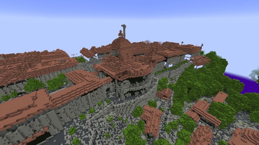
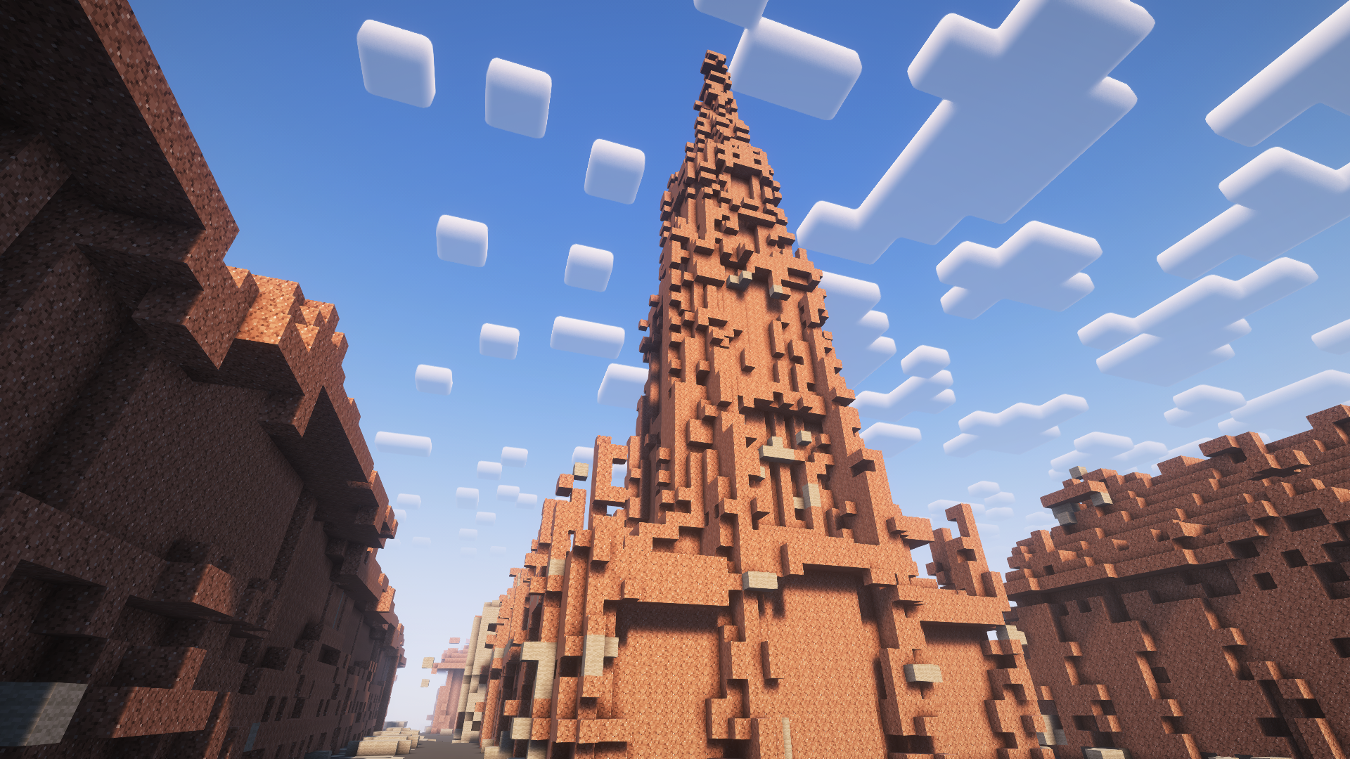
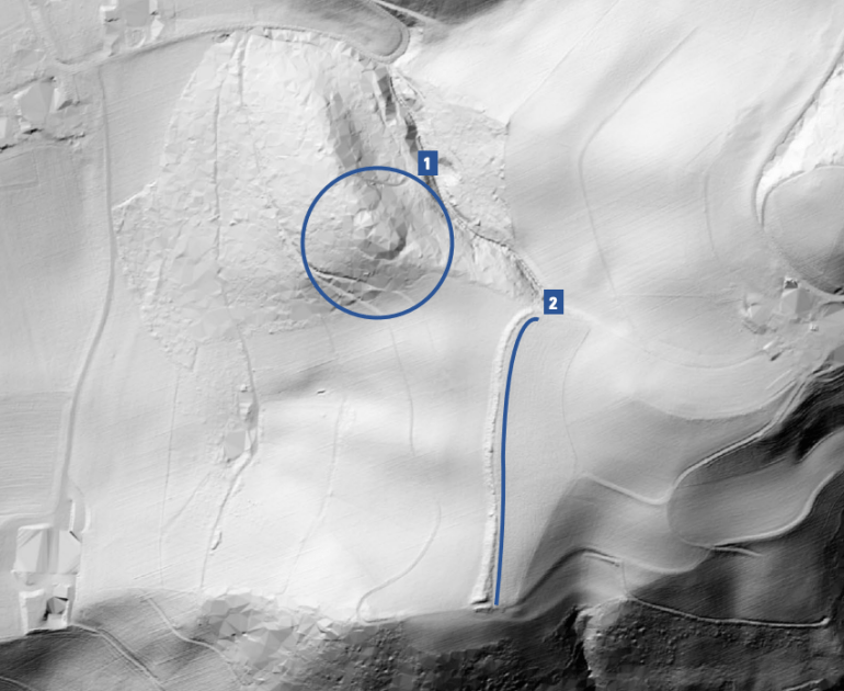
A massive inspiration is the Build The Earth project, a "collaborative effort to create a 1:1 scale model of Earth in the sandbox video game Minecraft". The local community called Alps BTE has been working for years, making steady progress on their virtual Switzerland and neighbouring countries accessible in this game - as captured in this early footage of the Bern maps that we shared with the team:
Note that the approach here is quite different from the hackathon project. The buildings and infrastructures are painstakingly constructed block-by-block using visual references - very much like a painter would create a picture of the landscape. This inspiring and artistic work is being featured until October 12 in the Landsichtssache - Musée Visionnaire exhibition. You can visit the locations in Minecraft, see an online Gallery of the latest buildings, and join in the crowdsourced efforts to create a digital Switzerland, Europe, and Earth yourself on the Alps BTE website.
Closing thoughts
It was quite inspiring to watch every team do it's thing, and I could write similar exposés on each of the completed Data Hackdays BE projects. You can conveniently browse through all the results of this events in the Backboard.
I have even had thoughts about turning this into a podcast of sorts, encouraged by recent attention from people in research and journalism. If you have some ideas or want to help me accomplish more in this area, please get in touch. Any feedback to this blog (just write oleg@) would already be super helpful.
I'm also happy to connect you with teams if you'd like to build on such projects yourself. Arguably an excellent place to do that is the Next Hackathon - so, hopefully, see you there 🤗 Thanks for reading!
 The works on this blog are licensed under a Creative Commons Attribution 4.0 International License
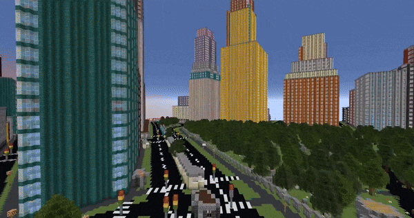